


Northern Kentucky Area Development District (North Central)--Kenton County PUMA, Kentucky
About
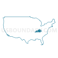
Outline
--Kenton+County+PUMA%2c+Kentucky_A280.png)
Summary
| Unique Area Identifier | 192984 |
| Name | Northern Kentucky Area Development District (North Central)--Kenton County PUMA |
| State | Kentucky |
| Area (square miles) | 164.35 |
| Land Area (square miles) | 160.25 |
| Water Area (square miles) | 4.10 |
| % of Land Area | 97.51 |
| % of Water Area | 2.49 |
| Latitude of the Internal Point | 38.93047710 |
| Longtitude of the Internal Point | -84.53349200 |
Maps
--Kenton+County+PUMA in Kentucky.png)
Graphs
Select a template below for downloading or customizing gragh for Northern Kentucky Area Development District (North Central)--Kenton County PUMA, Kentucky
--Kenton+County+PUMA%2c+Kentucky_T0.png)
--Kenton+County+PUMA%2c+Kentucky_T1.png)
--Kenton+County+PUMA%2c+Kentucky_T2.png)
--Kenton+County+PUMA%2c+Kentucky_T3.png)
--Kenton+County+PUMA%2c+Kentucky_T4.png)
--Kenton+County+PUMA%2c+Kentucky_T5.png)
--Kenton+County+PUMA%2c+Kentucky_T6.png)
--Kenton+County+PUMA%2c+Kentucky_T7.png)
--Kenton+County+PUMA%2c+Kentucky.png)
Neighbors
Neighoring Public Use Microdata Area (by Name) Neighboring Public Use Microdata Area on the Map
- Cincinnati City (Central) PUMA, OH
- Cincinnati City (West) PUMA, OH
- Northern Kentucky Area Development District (Northwest)--Boone County PUMA, KY
- Northern Kentucky Area Development District (Southeast) PUMA, KY
Top 10 Neighboring County (by Population) Neighboring County on the Map
- Hamilton County, OH (802,374)
- Kenton County, KY (159,720)
- Boone County, KY (118,811)
- Campbell County, KY (90,336)
- Grant County, KY (24,662)
- Pendleton County, KY (14,877)
Top 10 Neighboring County Subdivision (by Population) Neighboring County Subdivision on the Map
- Cincinnati city, Hamilton County, OH (296,943)
- Covington CCD, Kenton County, KY (111,047)
- Newport-Fort Thomas CCD, Campbell County, KY (68,138)
- Florence CCD, Boone County, KY (64,720)
- Independence CCD, Kenton County, KY (41,147)
- Walton CCD, Boone County, KY (19,104)
- Alexandria CCD, Campbell County, KY (14,544)
- Crittenden CCD, Grant County, KY (8,128)
- Grants Lick CCD, Campbell County, KY (7,654)
- Piner-Visalia CCD, Kenton County, KY (7,526)
Top 10 Neighboring Place (by Population) Neighboring Place on the Map
- Cincinnati city, OH (296,943)
- Covington city, KY (40,640)
- Florence city, KY (29,951)
- Independence city, KY (24,757)
- Erlanger city, KY (18,082)
- Newport city, KY (15,273)
- Edgewood city, KY (8,575)
- Elsmere city, KY (8,451)
- Fort Mitchell city, KY (8,207)
- Villa Hills city, KY (7,489)
Top 10 Neighboring Unified School District (by Population) Neighboring Unified School District on the Map
- Cincinnati City School District, OH (330,202)
- Boone County School District, KY (112,752)
- Kenton County School District, KY (98,715)
- Campbell County School District, KY (41,926)
- Covington Independent School District, KY (33,049)
- Grant County School District, KY (21,084)
- Erlanger-Elsmere Independent School District, KY (16,949)
- Newport Independent School District, KY (15,502)
- Pendleton County School District, KY (14,877)
- Walton-Verona Independent School District, KY (6,059)
Top 10 Neighboring State Legislative District Lower Chamber (by Population) Neighboring State Legislative District Lower Chamber on the Map
- State House District 32, OH (103,395)
- State House District 31, OH (97,992)
- State House District 60, KY (61,922)
- State House District 66, KY (52,522)
- State House District 64, KY (49,008)
- State House District 61, KY (44,092)
- State House District 69, KY (43,827)
- State House District 68, KY (42,414)
- State House District 78, KY (41,569)
- State House District 63, KY (40,380)
Top 10 Neighboring State Legislative District Upper Chamber (by Population) Neighboring State Legislative District Upper Chamber on the Map
- State Senate District 9, OH (298,658)
- State Senate District 11, KY (137,257)
- State Senate District 17, KY (133,729)
- State Senate District 24, KY (105,213)
- State Senate District 23, KY (98,810)
Top 10 Neighboring 111th Congressional District (by Population) Neighboring 111th Congressional District on the Map
- Congressional District 4, KY (741,464)
- Congressional District 2, OH (673,873)
- Congressional District 1, OH (598,699)
Top 10 Neighboring Census Tract (by Population) Neighboring Census Tract on the Map
- Census Tract 636.05, Kenton County, KY (10,587)
- Census Tract 653, Kenton County, KY (9,730)
- Census Tract 636.03, Kenton County, KY (8,318)
- Census Tract 9201, Grant County, KY (8,128)
- Census Tract 668, Kenton County, KY (7,704)
- Census Tract 9301, Pendleton County, KY (7,011)
- Census Tract 701, Boone County, KY (6,680)
- Census Tract 702, Boone County, KY (6,368)
- Census Tract 640, Kenton County, KY (6,313)
- Census Tract 656, Kenton County, KY (6,263)
Top 10 Neighboring 5-Digit ZIP Code Tabulation Area (by Population) Neighboring 5-Digit ZIP Code Tabulation Area on the Map
- 41042, KY (49,968)
- 41017, KY (38,940)
- 41018, KY (27,345)
- 41051, KY (26,796)
- 41011, KY (25,872)
- 41071, KY (20,869)
- 41015, KY (20,864)
- 41076, KY (16,468)
- 41001, KY (16,412)
- 45202, OH (15,483)